Having traveled to and through New Mexico numerous times over several decades, my husband Larry had often passed by a sign on US 87 touting Capulin Volcano. But he never stopped to check it out.
That’s where my curiosity comes in. I can’t pass up anything that is part of the National Park System. When I saw that Capulin Volcano is a National Monument, I knew we were about to take a detour.
Intriguing sign that piqued my interest
Actually it’s less than three miles from the main
highway, a short drive on NM 325 (30 miles east of Raton on I-25). And well
worth a visit.
Capulin Volcano is the result of an eruption 60,000 years ago. Glowing lava spewed high into the sky, solidified, and dropped back to Earth, accumulating around the vent or opening. The eruption produced volcanic rocks that formed Capulin into a cinder cone volcano.
Early in the eruption, the first of four lava flows spread eastward from the cinder cone’s base. Later eruptions resulted in lava flows on the south, southwest, and west sides of the cone. Super-heated lava flows cooled while lava continued to flow underneath, resulting in interesting ridges that are perpendicular to the flow direction.
Capulin rises over 1,300 feet above the plains,
8,182 feet above sea level. As natural forces changed volcanic rock into soil, plants
eventually took root. Prairie grasses, wildflowers, and pine trees began to proliferate.
Since the volcano lies at the base of the Rocky Mountains, it straddles two
very different habitats--the grassland of the plains and the forest of the
mountains. Lava flows extend on the plains
far beyond the cone.
In addition to getting information at the Visitor
Center, you can actually walk on the volcano or venture into its crater. We
walked the moderate one-mile loop called Crater Rim Trail. It was our first
high altitude adventure on this trip, and we soon learned to go a little slower
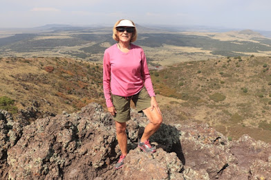
than our start. On the rim you have sweeping views of lava flows that extend
far beyond the park boundary covering almost 16 square miles. If the day is
really clear, you might be able to see New Mexico, Texas, Colorado, and
Oklahoma from the rim trail’s highest point.
The volcano is extinct, so you’re probably safe
descending 105 feet to the bottom of the crater on the short Crater Vent Trail.
Or take an easy, paved 10-minute nature walk from the Visitor Center for
close-up views of prairie landscape and lava formations.
To see rugged lava exposed, venture further on an
unpaved one-mile loop called the Lava Flow Trail. Or try Boca Trail, a more
strenuous two-mile unpaved loop that navigates lava flows and lakes, lava
tubes, and a spatter hill. Extensive views from the rim of Capulin Volcano
We spent an enjoyable hour traversing this
symmetrical cinder volcano and observed nature’s recovery from the fiery
eruption over many thousands of years. During our late September visit we saw
the beginnings of fall color on the slopes; during spring, wildflowers create a
lovely mosaic among the cinders. Picnicking and birding are also popular
activities.


No comments:
Post a Comment